Home/Blog
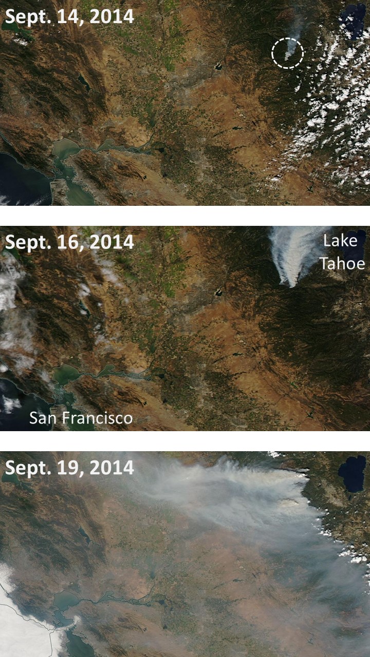
The massive King Fire 60 miles east of Sacramento, CA was deliberately set on Sept. 14, and still remains mostly uncontained due to the drought and shifting winds.
It has burned over 120 square miles of forest, including some homes, and has required the use of a record amount of fire retardant dropped from aircraft.
The MODIS instruments on NASA’s Terra and Aqua satellites captured the following three images as the fire progressed, with winds eventually blowing smoke over much of Northern California, including the San Francisco Bay area: