
 Home/Blog
The latest GFS weather forecast model run shows much of central and northern Florida running 20 deg. F below normal by sunrise on Sunday morning, the result of a fast-moving cold front plunging south out of Canada.
Here’s the graphic, courtesy of our friends at Weatherbell.com:
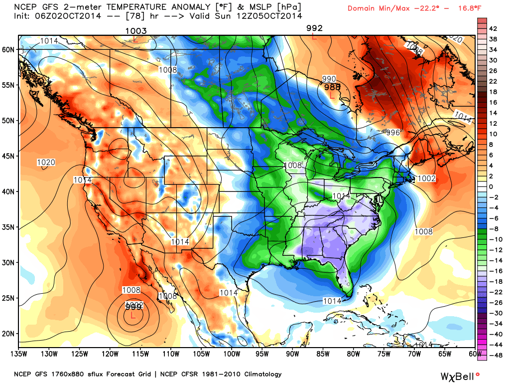
3-day GFS model forecast of surface temperature departures from normal for Sunday morning, Oct. 5, 2014.
Rather than my usual global warming snark, I’m just going to say ENJOY!


