When a tropical cyclone moves poleward and merges with a frontal system, and then draws upon the extra energy that exists between cold and warm air masses, a Sandy-type storm can result.
Sometimes it causes explosive cyclogenesis, what we call a “bomb”, with rapidly deepening low surface pressures.
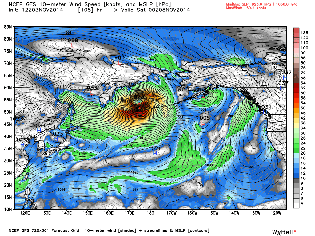
I’ve been watching Super Typhoon Nuri in the West Pacific, one of the strongest of the year, and each run of the GFS model continues to show this system becoming a spectacular extratropical storm in the Bering Sea, with hurricane force winds and near record low barometric pressure in about 5 days time, after it just misses Japan.
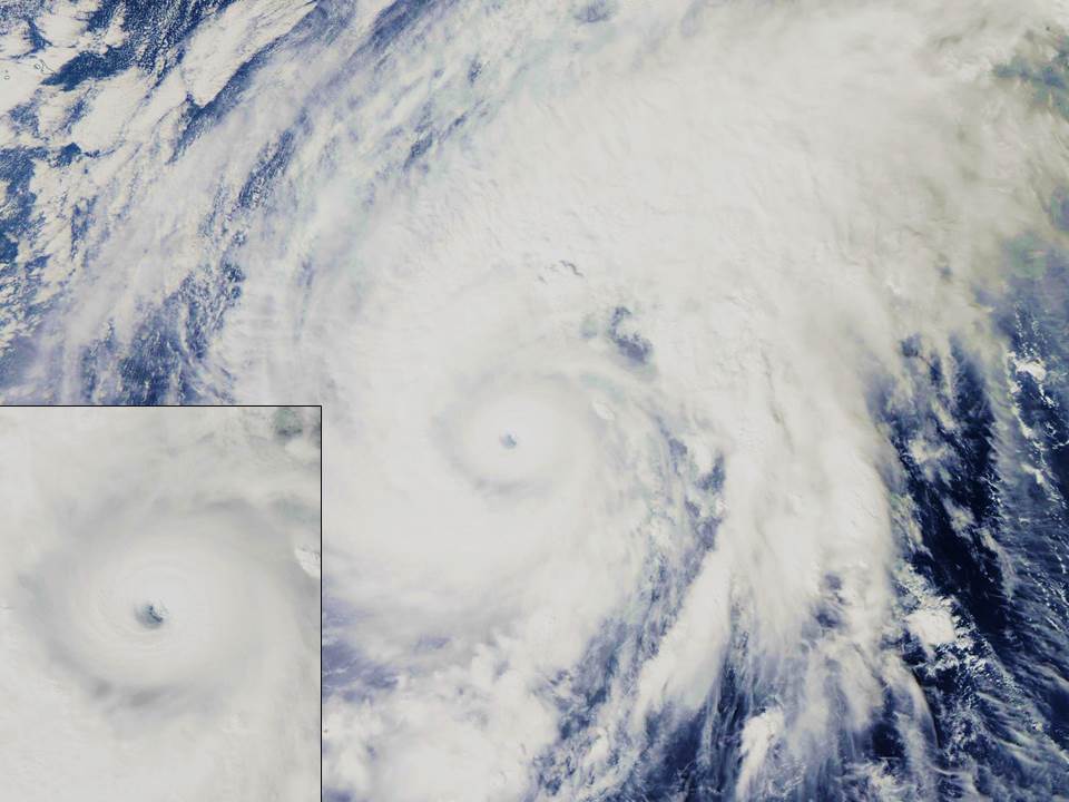
As of today, this is what Nuri looks like in the latest MODIS imagery…it’s not a particularly large storm, but it has an intense core, with maximum surface winds estimated at 180 mph with gusts to 220 mph (these are satellite-estimated…they do not routinely fly into typhoons to measure them like we do in the West Atlantic):
Here’s some nice video of Nuri from the International Space Station from yesterday:
The GFS forecast model run from this morning shows Nuri as an extratropical low with an exceedingly low central pressure of 924 mb (27.29 inches) by Friday evening (graphic courtesy of Weatherbell.com, click image for full-size):

GFS model forecast surface pressures and winds when extratropical cyclone Nuri reaches peak intensity, Friday evening Nov. 7, 2014.
The previous 2 model runs had the low at 919 mb lowest pressure. By comparison, the lowest pressures recorded in extratropical storms have been in the range of 912-920 mb, in the North Atlantic, so it looks like Nuri might be one of the strongest on record. The lowest surface pressure ever recorded in the U.S. was from one of these Bering Sea systems: 927 mb (27.35 inches) at Dutch Harbor, Alaska on October 25, 1977.

 Home/Blog


