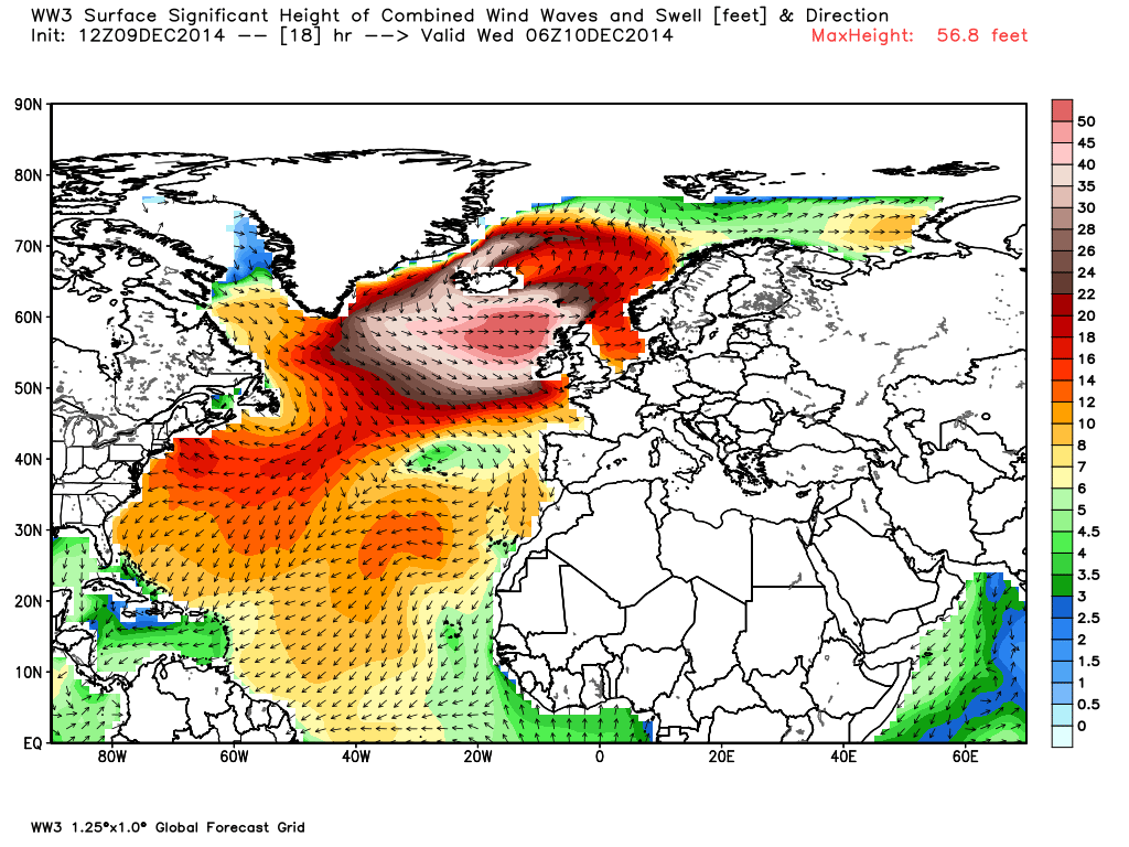
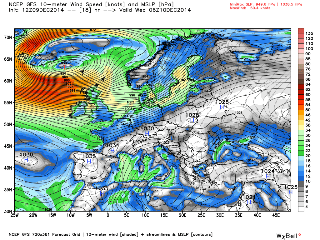
A strong low pressure “bomb” southeast of Greenland tracking eastward today will bring high winds and “phenomenal” waves to the west coast of the UK by Wednesday morning, with open-ocean winds exceeding 60 knots and wave heights as much as 50 feet or more.
The wave height field forecast for sunrise Wednesday shows what the Stornoway (Scotland) Coastguard is anticipating will be a “phenomenal” sea state (graphics courtesy of Weatherbell.com, click images for full-size):
The sea level pressure and wind patterns for the same time show the location of the low pressure and high near-surface winds:
Some schools near the northwest coasts have been closed tomorrow in anticipation of the storm.

 Home/Blog


