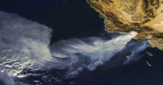
The warm, dry Santa Ana winds which are fanning the flames of the wildfires in the L.A. area have pushed the smoke hundreds of miles offshore. Yesterday’s NASA MODIS imager on the Terra satellite captured the following image of the smoke being sheared into artistic shapes as it travels downwind. Click on the image for the full-resolution version.

NASA MODIS image of LA wildfire smoke on 6 December 2017. The red dots show locations of satellite-detected hotspots where fires are most intense.
The red dots indicate locations where the satellite sensor is detecting hotspots where the fire is most intense.

 Home/Blog


