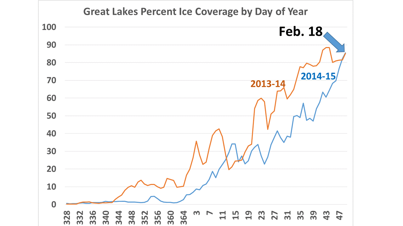
The recent frigid weather has led to a rapid freezing cycle on the Great Lakes, with ice cover increasing by another 20% in the last 10 days, which makes it now equal to last year’s epic coverage by this date (Great Lakes ice data available at GLERL):
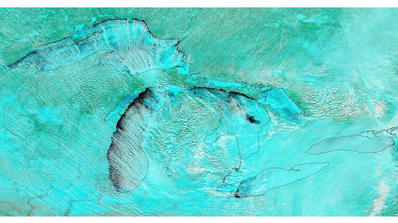
Here’s the latest MODIS false-color satellite image of the Great Lakes from yesterday, Feb. 18, 2015:

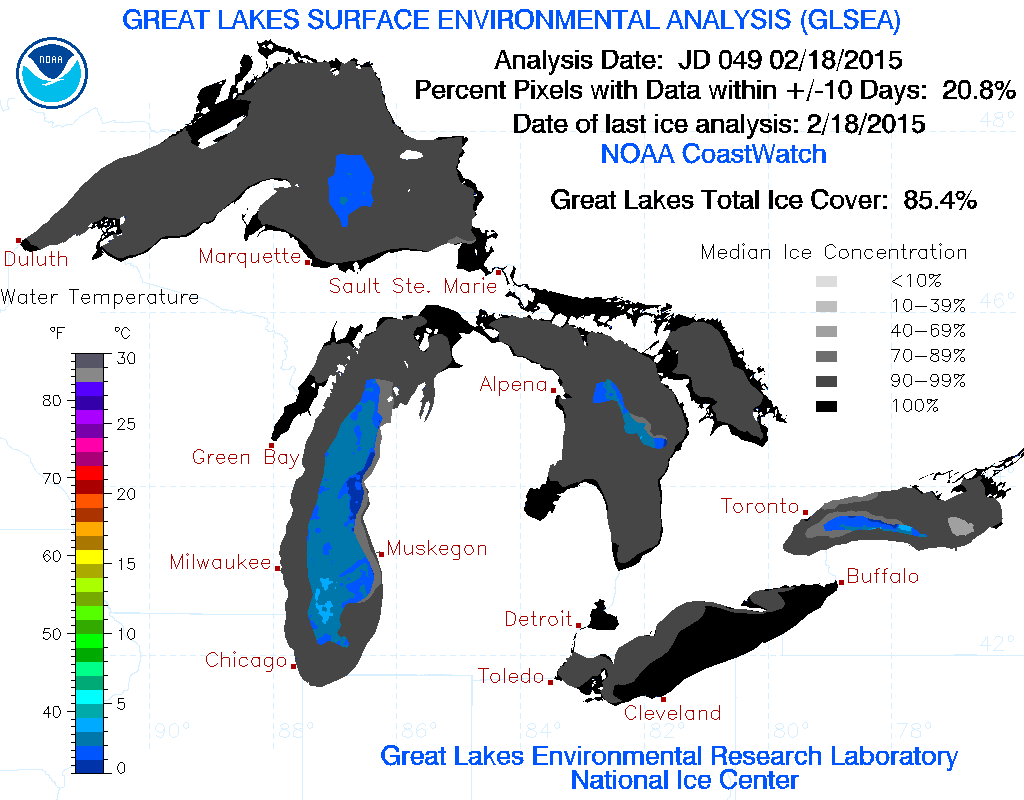
And here’s the official GLERL ice cover analysis for yesterday, which gives current coverage at 85.4%:

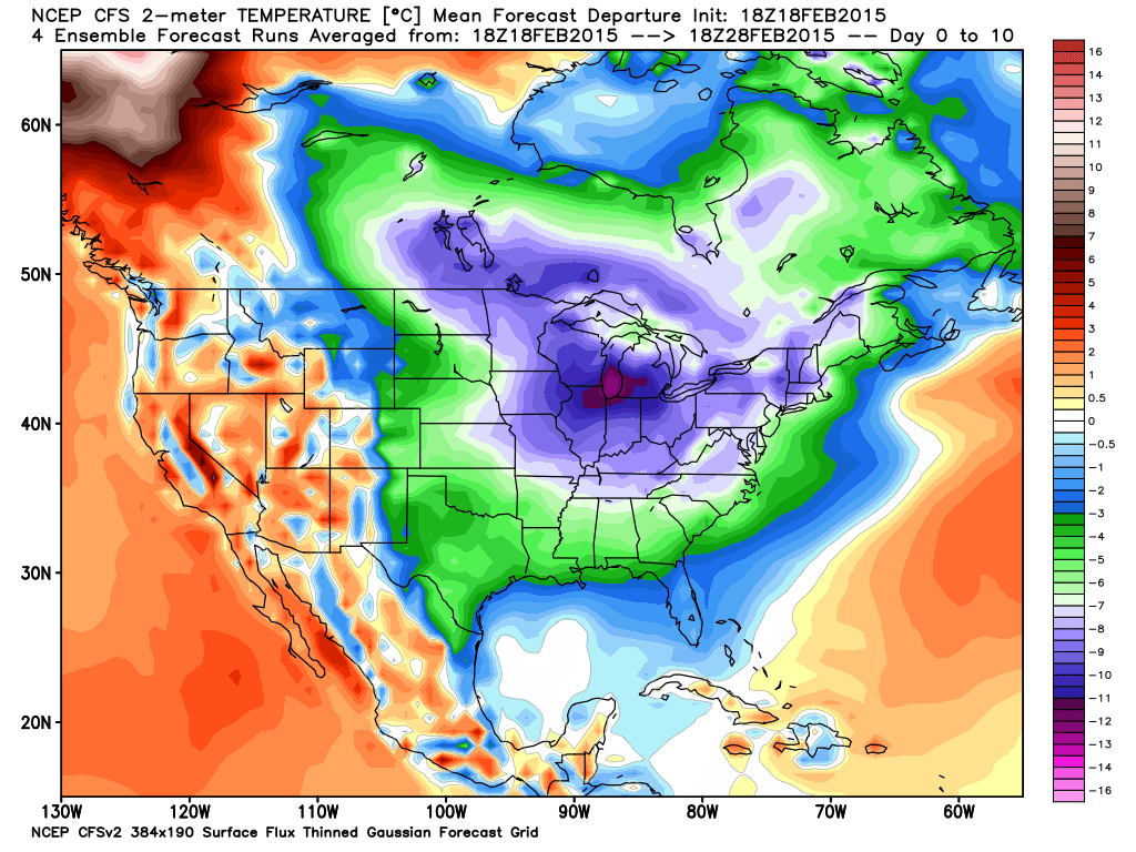
As the following graphic shows, the forecast temperatures for the next 10 days over the Great Lakes will be running an average of 15-20 deg. F below normal, so we could be looking at another record-setting ice cover season (graphic courtesy of Weatherbell.com):


 Home/Blog


