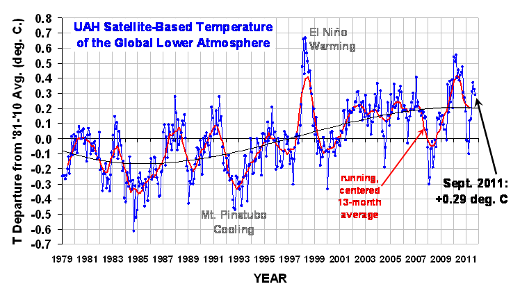
The global average lower tropospheric temperature anomaly for September, 2011 retreated a little again, to +0.29 deg. C (click on the image for the full-size version):

The 3rd order polynomial fit to the data (courtesy of Excel) is for entertainment purposes only, and should not be construed as having any predictive value whatsoever.
Here are this year’s monthly stats:
YR MON GLOBAL NH SH TROPICS
2011 1 -0.010 -0.055 0.036 -0.372
2011 2 -0.020 -0.042 0.002 -0.348
2011 3 -0.101 -0.073 -0.128 -0.342
2011 4 +0.117 +0.195 +0.039 -0.229
2011 5 +0.133 +0.145 +0.121 -0.043
2011 6 +0.315 +0.379 +0.250 +0.233
2011 7 +0.374 +0.344 +0.404 +0.204
2011 8 +0.327 +0.321 +0.332 +0.155
2011 9 +0.289 +0.309 +0.270 +0.175
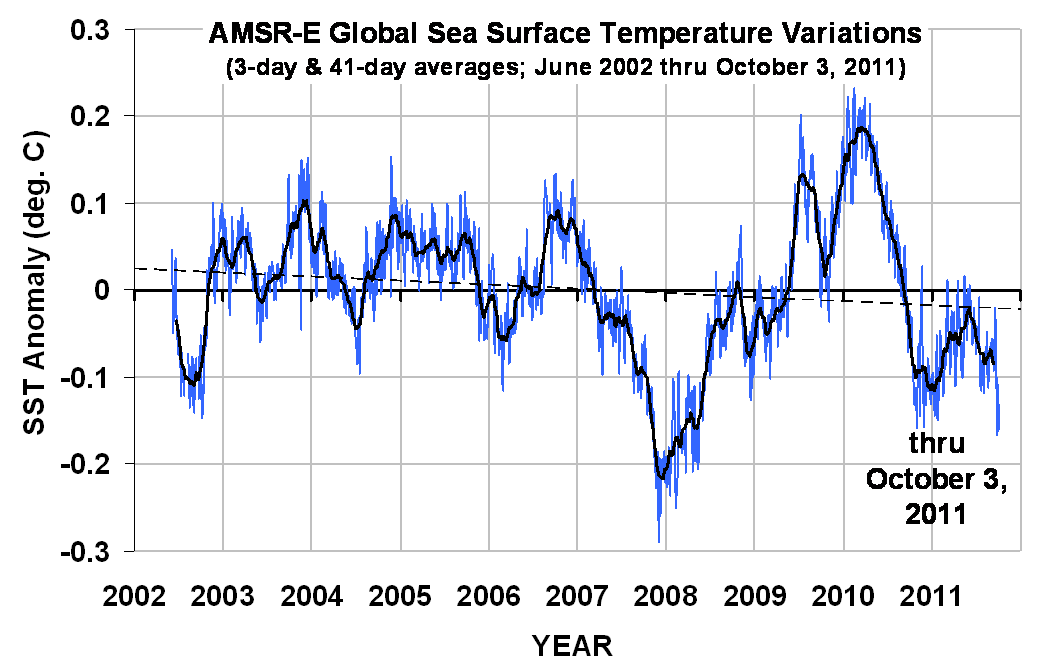
The global sea surface temperatures from AMSR-E through the end of AMSR-E’s useful life (October 3, 2011) are shown next. The trend line is, again, for entertainment purposes only:

On the subject of the drop-off in temperatures seen in the AMSR-E data in the last week, I have been getting questions about the daily AMSU tracking data at the Discover website which shows Aqua AMSU channel 5 (which our monthly updates are computed from) is now entering record-low territory (for the date, anyway, and only since the Aqua record began in 2002). While I have always cautioned people against reading too much into week-to-week changes in global average temperature, this could portend a more significant drop in the next (October) temperature update, as the new La Nina approaches.

 Home/Blog


