Even though it’s still early November, a January-like cold wave just entering Montana and the Dakotas on Sunday will bring 30 below zero temperatures to scattered locations in Montana and Wyoming by Wednesday morning.
The cold will fill the nation’s midsection by mid-week, with no let up in sight. The coldest air to arrive in a series of reinforcing surges is still a week away.
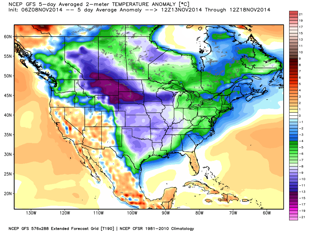
Temperatures are forecast to run 15 to 30 deg. F below normal for at least 5 days over a large portion of the central U.S. starting late in the coming week (graphic courtesy of Weatherbell.com, click to enlarge):

Forecast temperature departures from normal for the five day period Thursday Nov. 13 to Monday Nov. 18, 2014.
On individual days the temperatures will be as much as 50 deg. F below normal for this time of year, which is quite exceptional. The air mass temperature (850 mb, ~5,000 ft. altitude) will be as much as 4.5 standard deviations below normal, which is less than 1 in 100,000 in probability terms.

 Home/Blog


